Plaetje:Map - NL - Municipality code 0983 (2009).svg

Aafmaetinge van dees veurbesjoewing van 't type PNG van dit SVG-bestandj: 300 × 160 pixels Anger resoluties: 320 × 171 pixels | 640 × 341 pixels | 1.024 × 546 pixels | 1.280 × 683 pixels | 2.560 × 1.365 pixels.
Oearsprunkelik bestandj (SVG-bestandj, nominaal 300 × 160 pixels, bestandsgruutde: 531 kB)
| Besjrieving |
|
|||
| Datum | ||||
| Brón | own work , using CBS data | |||
| Sjriever | Michiel1972 (talk) 23:54, 24 January 2009 (UTC) | |||
| Permissie (Hergebroek van dit besjtandj) |
Attribution ShareAlike 3.0 |

.svg)
Dit bestandj steit gelicenseerdj óngere Creative Commons Attribution-Share Alike 3.0 Unported lisensje.
- De maags:
- deile – aafsjrieve, verspreie en dórchgaeve
- hèrminge – 't wèrk aanpasje
- Óngere volgendje veurwaerj:
- Attribuusje – Geer mótj op 'n gepasdje meneer 'n naamsvermeljing make, 'ne link nao de licentie opgaeve, en aangaeve of g'r 't werk verangerd höb. Geer moog dit op eder raejelike meneer doon, meh neet zoea det 't liek ofwen de licentiegaever instump mit eur werk of eur gebroek van zie werk.
- Deil gliek – Went geer dit werk geremix, verangerd of doorverwirk höb, mótj geer 't verangerd matterjaal verspreie ónger dezelfde licentie wie 't oersjprunkelik werk, of 'n licentie die daomit samegeit.
Besjtandshistorie
Klik op 'ne datum/tied óm 't besjtand te zeen wie 't oetzaog op det tiedsjtip.
| Datum/Tied | Miniatuurplaetje | Aafmaetinge | Gebroeker | Kómmentaar | |
|---|---|---|---|---|---|
| hujig | 7 okt 2019 23:22 | | 300 × 160 (531 kB) | Thayts | Reverted to version as of 23:54, 24 January 2009 (UTC) - does not match name (2009) anymore |
| 19 dec 2010 10:50 |  | 300 × 160 (39 kB) | Hannes Karnoefel | arcen en velden erbij | |
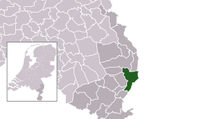
| 25 jan 2009 01:54 |  | 300 × 160 (531 kB) | Michiel1972 | {{Information |Description=*Location maps for the 441 municipalities in the Netherlands. Boundaries 1/1/2009 *Automatically generated with script *File name contains "Municipality code" (CBS-code) as specified in: [http://www.cbs.nl/nl-NL/menu/methoden/c |
Plaetjesverwiezinge
Dit plaetje weurt op de volgende pazjena's gebroek:
Globaal besjtandjsgebroek
De volgende anger wiki's gebroeke dit bestandj:
- Gebroek in ar.wikipedia.org
- Gebroek in arz.wikipedia.org
- Gebroek in ca.wikipedia.org
- Gebroek in el.wikipedia.org
- Gebroek in en.wikipedia.org
- Gebroek in eo.wikipedia.org
- Gebroek in eu.wikipedia.org
- Gebroek in fa.wikipedia.org
- Gebroek in fr.wikipedia.org
- Gebroek in hy.wikipedia.org
- Gebroek in it.wikipedia.org
- Gebroek in ko.wikipedia.org
- Gebroek in la.wikipedia.org
- Gebroek in lb.wikipedia.org
- Gebroek in mk.wikipedia.org
- Gebroek in nds-nl.wikipedia.org
- Gebroek in pt.wikipedia.org
- Gebroek in ru.wikipedia.org
- Gebroek in stq.wikipedia.org
- Gebroek in ur.wikipedia.org
- Gebroek in www.wikidata.org
.svg)