Plaetje:Kingdoms of Israel and Judah map 830.svg

Oearsprunkelik bestandj(SVG-bestandj, nominaal 720 × 859 pixels, bestandsgruutde: 96 kB)

Gaef dit plaetje waor in de spraok .

Dit besjtandj kump van Wikimedia Commons en kin ouch in anger projekte gebroek waere. De pagina mit de besjtandjsbesjrieving wurt hiejónger weergegaeve.

Besjrieving
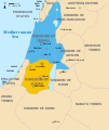
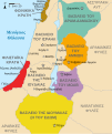
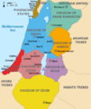
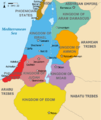
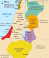
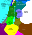
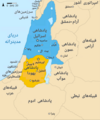
English: Approximate map showing the Kingdoms of Israel (blue) and Judah (orange), ancient Southern Levant borders and ancient cities such as Urmomium and Jerash. The map shows the region in the 9th century BCE.
Italiano: Il regno di Giuda e quello di Israele nell'età del ferro (VIII secolo a.C.).
日本語: 紀元前830年代のユダ王国(黄色).
Русский: Царство Иудея 927 по 526 гг. до н. э. Отсюда иудеи были сосланы завоевателями в Вавилонский регион.
Bahasa Indonesia: Peta kerajaan-kerajaan di daerah tersebut pada abad 9 SM.
Simple English: The northern Kingdom of Israel and the Kingdom of Judah to the south.
Srpskohrvatski / српскохрватски: Karta Sjevernog i JUžnog Kraljevstva. Samarija je bila glavni grad Kraljevstva Izrael (plavo). 830-e pne.,.
Latviešu: Izraēlas un Jūdejas karalistes. Jūdejas karaliste (dzeltenā) ap 830. gadu p.m.ē.
Datum (UTC)
Brón http://www.jewishvirtuallibrary.org/map-of-israel-and-judah-733-bce
Sjriever
Anger versies

[bewirk]

Color scheme 1
Color scheme 2
Israel and Judah colored
Just Israel and Judah
Ich, de kopierechhaajer hievan, bring 't hiebie óngere vólgendje lisensje oet:
w:nl:Creative Commons
Attribuusje Deil gliek
Dit bestandj steit gelicenseerdj óngere Creative Commons Attribution-Share Alike 3.0 Unported lisensje.
De maags:
  • deile – aafsjrieve, verspreie en dórchgaeve
  • hèrminge – 't wèrk aanpasje
Óngere volgendje veurwaerj:
  • Attribuusje – Geer mótj op 'n gepasdje meneer 'n naamsvermeljing make, 'ne link nao de licentie opgaeve, en aangaeve of g'r 't werk verangerd höb. Geer moog dit op eder raejelike meneer doon, meh neet zoea det 't liek ofwen de licentiegaever instump mit eur werk of eur gebroek van zie werk.
  • Deil gliek – Went geer dit werk geremix, verangerd of doorverwirk höb, mótj geer 't verangerd matterjaal verspreie ónger dezelfde licentie wie 't oersjprunkelik werk, of 'n licentie die daomit samegeit.
GNU head Toesteumming wert verleend veur t kopiëre, verspreide en/of wiezige van dit document onger de veurwaerd van de GNU-licentie veur vrieje documentatie, versie 1.2 of einige latere versie es gepubliceerd door de Free Software Foundation; zonger Invariant Sections, zonger Front-Cover Texts, en zonger Back-Cover Texts. n kopie van de licentie is opgenomme in de sectie GNU-licentie veur vrieje documentatie.
De kens zelf de lisensje oetkeze.

Orzjineel uploadlogbook

This image is a derivative work of the following images:

  • File:Oldtidens_Israel_&_Judea.svg licensed with Cc-by-sa-3.0, GFDL
    • 2010-01-30T16:10:36Z FinnWikiNo 726x868 (109641 Bytes) {{Information |Description={{en|1=Map showing the ancient levant borders and ancient cities such as [[Urmomium]] and [[Jerash]]. The map also shows the region in the 9th century BCE. Notice the coastal land of Philistia, from

Uploaded with derivativeFX

Bijschriften

Beschrijf in één regel wat dit bestand voorstelt

Items getoond in dit bestand

beeldt af Nederlands

Koninkrijk Juda Nederlands

12 jul 2010

MIME-type Nederlands

image/svg+xml

Besjtandshistorie

Klik op 'ne datum/tied óm 't besjtand te zeen wie 't oetzaog op det tiedsjtip.

Datum/TiedMiniatuurplaetjeAafmaetingeGebroekerKómmentaar
hujig1 okt 2021 16:12Miniatuurplaetje veur versie per 1 okt 2021 16:12720 × 859 (96 kB)SadopaulFile uploaded using svgtranslate tool (https://svgtranslate.toolforge.org/). Added translation for ko.
10 fib 2017 17:50Miniatuurplaetje veur versie per 10 fib 2017 17:50720 × 859 (80 kB)Malus Catulusremoved 'Sizu' - a weird artifact from the Norse original
13 fib 2011 01:48Miniatuurplaetje veur versie per 13 fib 2011 01:48720 × 859 (78 kB)Malus Catulus-
13 jul 2010 13:29Miniatuurplaetje veur versie per 13 jul 2010 13:29720 × 859 (79 kB)Malus CatulusFixed Judah color
13 jul 2010 12:51Miniatuurplaetje veur versie per 13 jul 2010 12:51720 × 859 (79 kB)Malus CatulusAdded colors for the two kingdoms and converted their text to path and arial
13 jul 2010 01:53Miniatuurplaetje veur versie per 13 jul 2010 01:53720 × 859 (62 kB)Malus CatulusShrinked down the borders
12 jul 2010 21:43Miniatuurplaetje veur versie per 12 jul 2010 21:43720 × 859 (62 kB)Malus Catulus{{Information |Description={{en|1=Map showing the ancient levant borders and ancient cities such as Urmomium and Jerash. The map also shows the region in the 9th century BCE. Notice the coastal land of Philistia, from which the name "Palestine

Dit plaetje weurt op de volgende pazjena's gebroek:

Globaal besjtandjsgebroek

De volgende anger wiki's gebroeke dit bestandj:

Bekiek wikiwied gebroek van dit bestandj.

Metadata