Plaetje:Chièvres Hainaut Belgium Map.png
Gein hoeger resolutie besjikbaar.
Chièvres_Hainaut_Belgium_Map.png ((355 × 278 pixel, besjtandsgruutde: 8 kB, MIME type: image/png))

|
Bestand:Chièvres Hainaut Belgium Map.svg is een vectorversie van dit bestand. Indien niet van slechtere kwaliteit dient deze gebruikt te worden in plaats van deze rasterafbeelding.
File:Chièvres Hainaut Belgium Map.png → File:Chièvres Hainaut Belgium Map.svg
Zie Help:SVG voor meer informatie. |
 |
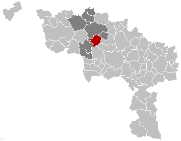
English: Map, municipality belgium Chièvres
Français : Carte indiquant la localisation de la commune de Chièvres dans la Province de Hainaut.
English: Map from w:nl:Gebruiker:LennartBolks/kaartenhoekje in Public Domain by the Author choice.
| Dit wirk vrijgegeve in 't publiek domein door de autäör, LennartBolks. Dit is wereldwijd vaan toupassing. In sommig len is dit wettelik neet meugelek; in die gevalle gelt: |
Besjtandshistorie
Klik op 'ne datum/tied óm 't besjtand te zeen wie 't oetzaog op det tiedsjtip.
| Datum/Tied | Miniatuurplaetje | Aafmaetinge | Gebroeker | Kómmentaar | |
|---|---|---|---|---|---|
| hujig | 16 nov 2008 15:12 | | 355 × 278 (8 kB) | Wester | {{Information |Description= |Source= |Date= |Author= |Permission= |other_versions= }} |
| 25 mei 2006 19:34 |  | 355 × 278 (8 kB) | Profoss | ||
| 28 mrt 2005 23:36 |  | 355 × 278 (6 kB) | Nicnac25~commonswiki | Map, municipality belgium Chièvres {{PD}} FR; Carte indiquant la localisation de la commune de Chièvres dans la Province de Hainaut. EN; Map from w:nl:Gebruiker:LennartBolks/kaartenhoekje in Public Domain by the Author choice. [[Category:Maps of pr |
Plaetjesverwiezinge
Gein inkel pazjena gebroek dit plaetje.