Plaetje:California map showing Lake County.png
Gein hoeger resolutie besjikbaar.
California_map_showing_Lake_County.png ((200 × 231 pixel, besjtandsgruutde: 22 kB, MIME type: image/png))
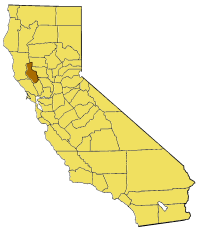
Map of Lake county in California. From en:

|
Toesteumming wert verleend veur t kopiëre, verspreide en/of wiezige van dit document onger de veurwaerd van de GNU-licentie veur vrieje documentatie, versie 1.2 of einige latere versie es gepubliceerd door de Free Software Foundation; zonger Invariant Sections, zonger Front-Cover Texts, en zonger Back-Cover Texts. n kopie van de licentie is opgenomme in de sectie GNU-licentie veur vrieje documentatie. |
| Dit bestandj steit gelicenseerdj óngere Creative Commons Attribution-Share Alike 3.0 Unported lisensje. | ||
| ||
| Dees licentie-tag woort tougevoeg aon dit bestand in verband mèt de GFDL licentie-update. |
Besjtandshistorie
Klik op 'ne datum/tied óm 't besjtand te zeen wie 't oetzaog op det tiedsjtip.
| Datum/Tied | Miniatuurplaetje | Aafmaetinge | Gebroeker | Kómmentaar | |
|---|---|---|---|---|---|
| hujig | 1 jul 2005 19:03 | | 200 × 231 (22 kB) | Pyramide~commonswiki | Map of Lake county in California. From en: {{GFDL}} Category:Maps of counties in California |
Plaetjesverwiezinge
Dit plaetje weurt op de volgende pazjena's gebroek:
Globaal besjtandjsgebroek
De volgende anger wiki's gebroeke dit bestandj:
- Gebroek in bg.wikipedia.org
- Gebroek in en.wikipedia.org
- Stone House (Lake County, California)
- Old Lake County Courthouse (California)
- Rattlesnake Island (Clear Lake)
- Template:LakeCountyCA-geo-stub
- Forbes Creek (California)
- Clear Lake Volcanic Field
- Loch Lomond, California
- Whispering Pines, California
- Little Blue Peak
- Clearlake Highlands, California
- Buckingham Park, California
- Clearlake Park, California
- Dahnohabe, California
- Finley, California
- Glenhaven, California
- Guenoc, California
- Harbin Springs, California
- Hullville, California
- Khawina, California
- Koi, California
- Lolsel, California
- Olposel, California
- Parramore Springs
- Pine Grove, Lake County, California
- Hopitsewah, California
- Timber Lake (Lake County, California)
- Eastlake Landfill
- Great Western Mine (Lake County, California)
- Jericho Creek (Hunting Creek tributary)
- The Jams
- Seigler Canyon Creek
- Highland Springs Reservoir
- Hidden Valley Lake (California)
- Thurston Lake
- Adobe Reservoir
- Adobe Creek (Lake County, California)
- St. Helena Toll Road and Bull Trail
- Gebroek in pam.wikipedia.org
- Gebroek in www.wikidata.org