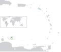
Plaetje:BES islands location map.svg

Aafmaetinge van dees veurbesjoewing van 't type PNG van dit SVG-bestandj: 698 × 599 pixels Anger resoluties: 280 × 240 pixels | 559 × 480 pixels | 894 × 768 pixels | 1.192 × 1.024 pixels | 2.385 × 2.048 pixels | 1.346 × 1.156 pixels.
Oearsprunkelik bestandj (SVG-bestandj, nominaal 1.346 × 1.156 pixels, bestandsgruutde: 177 kB)
Besjtandshistorie
Klik op 'ne datum/tied óm 't besjtand te zeen wie 't oetzaog op det tiedsjtip.
| Datum/Tied | Miniatuurplaetje | Aafmaetinge | Gebroeker | Kómmentaar | |
|---|---|---|---|---|---|
| hujig | 27 jun 2011 18:21 |  | 1.346 × 1.156 (177 kB) | Thayts | Strokes tweak |
| 7 mrt 2011 21:32 |  | 1.346 × 1.156 (177 kB) | Thayts | Strokes tweak | |
| 6 mrt 2011 17:58 |  | 1.346 × 1.156 (177 kB) | Thayts | Strokes tweak | |
| 6 mrt 2011 17:31 |  | 1.346 × 1.156 (177 kB) | Thayts | Darker gray | |
| 6 mrt 2011 14:54 |  | 1.346 × 1.156 (177 kB) | Thayts | Minor changes | |
| 5 mrt 2011 22:55 |  | 1.346 × 1.156 (214 kB) | Thayts | Minor changes | |
| 5 mrt 2011 22:40 |  | 1.346 × 1.156 (215 kB) | Thayts | Made circles darker for better visibility | |
| 5 mrt 2011 22:32 |  | 1.346 × 1.156 (215 kB) | Thayts | {{Information |Description={{en|Location map of the BES islands in the Lesser Antilles}} Equirectangular projection, N/S stretching 103 %. Geographic limits of the map: * N: 19.2° N * S: 9.7° N * W: 70.5° W * |
Plaetjesverwiezinge
Dit plaetje weurt op de volgende pazjena's gebroek:
Globaal besjtandjsgebroek
De volgende anger wiki's gebroeke dit bestandj:
- Gebroek in af.wikipedia.org
- Gebroek in ar.wikipedia.org
- Gebroek in arz.wikipedia.org
- Gebroek in awa.wikipedia.org
- Gebroek in azb.wikipedia.org
- Gebroek in az.wikipedia.org
- Gebroek in ban.wikipedia.org
- Gebroek in be.wikipedia.org
- Gebroek in bh.wikipedia.org
- Gebroek in blk.wikipedia.org
- Gebroek in bs.wikipedia.org
- Gebroek in ca.wikipedia.org
- Gebroek in ceb.wikipedia.org
- Gebroek in chy.wikipedia.org
- Gebroek in cs.wikipedia.org
- Gebroek in da.wikipedia.org
- Gebroek in de.wikipedia.org
- Gebroek in diq.wikipedia.org
- Gebroek in el.wikipedia.org
- Gebroek in en.wikipedia.org
- Gebroek in en.wiktionary.org
- Gebroek in eo.wikipedia.org
- Gebroek in es.wikipedia.org
- Gebroek in fa.wikipedia.org
- Gebroek in fi.wikipedia.org
- Gebroek in fr.wikipedia.org
- Gebroek in fy.wikipedia.org
- Gebroek in ga.wikipedia.org
- Gebroek in gd.wiktionary.org
- Gebroek in gl.wikipedia.org
- Gebroek in he.wikipedia.org
- Gebroek in hi.wikipedia.org
- Gebroek in hr.wikipedia.org
- Gebroek in hu.wikipedia.org
- Gebroek in hy.wikipedia.org
- Gebroek in ia.wikipedia.org
- Gebroek in id.wikipedia.org
Bekiek wikiwied gebroek van dit bestandj.